Surveying a property is a crucial step in ensuring it’s suitable for its intended use. It involves the collection and analysis of data related to the physical features, boundaries, and legal ownership of real estate.
A property surveyor actively identifies potential problems or risks with a piece of land before its purchase or development.
Through this process, buyers and developers are able to make informed decisions about their investments in the property market.
Property surveys help resolve neighbor disputes over shared lands. Understanding survey steps brings peace of mind to real estate projects.
What data do we collect and analyze in Property Surveying?
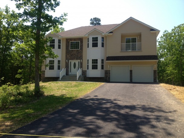
Understanding property surveys is crucial for owners. They ensure the accuracy of legal boundaries. Professional surveyors create detailed reports defining property boundaries. These include size, shape, and location. The survey is vital for owners and potential buyers. It confirms property lines match the deed’s legal description. MSC Enterprises specializes in real estate development in New Jersey. They offer leasing, management, and retail property development. They are experts at matching tenants with commercial real estate sites.
Property Surveying For Boundaries and Dimensions
People survey properties to determine exact boundaries and dimensions. The surveyor measures distances and marks property boundaries. They use metal stakes, painted lines, or markers. Boundary survey information is key for zoning regulations. It’s also important for future property construction.
Topography Property Surveying
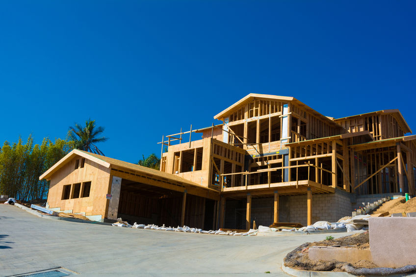
Topography studies land features, including natural and man-made structures. A property survey records these features with their location and elevation. This data determines optimal building and infrastructure placement. It helps prevent drainage problems or other issues. MSC Enterprises offers quality home building in Monmouth and Ocean County, New Jersey. We specialize in commercial and residential real estate development. Also offering leasing, management, and commercial property development services. We match tenants with ideal commercial real estate sites.
Property Surveying For Easements
Easements are legal agreements that allow other people or entities to use the property for a specific purpose, such as utility lines or public access. Property records keep all easements on the property, including their location and extent. This information is important for lenders, buyers, and sellers to have accurate boundaries, responsibilities, and rights.
Improvements to the Property
Improvements to a property, such as buildings, pools, sheds, fences, or driveways, may also be evaluated by property surveys. These improvements are measured to ensure that they are within the boundaries and are not infringing on any easements or other rights. The survey will also identify any potential encroachments liabilities, and zoning violations.
Natural Hazards
A property survey may also note any natural hazards on the property, such as flood zones or unstable land. Information about these hazards is crucial for the safety of future occupants, the insurance companies, and the local authorities. Flood-risk certification, soil characteristics, water courses, and topographical surveys provide data that is necessary to help mitigate risks and insure the property adequately.
Benefits of comprehensive Property Surveying before purchasing or developing land
One of the primary reasons why property surveys are necessary is that they provide an accurate representation of a property’s boundaries. A surveyor will use specialized equipment and techniques to identify and mark the precise locations of the property’s lines, ensuring that they align with the legal description provided in the property deed.
This information can be critical for determining a property’s value, as well as for resolving disputes with neighboring property owners over property lines.
There are different types of property surveys that a property owner can request, depending on their needs. A boundary survey, for example, is a survey that focuses on determining the property’s exact boundary lines.

This survey is especially useful for property owners who want to build a fence or make other improvements to their property that could affect their neighbor’s property. A topographic survey, on the other hand, is a survey that identifies the property’s physical features, such as its elevation, contours, and other characteristics. This type of survey is useful for property owners who want to build a new structure or make other changes to their property that could affect its natural features.
Property Surveying For Your Property Line
The first and most crucial benefit of conducting a comprehensive survey is to identify your property boundary lines. A land survey will provide you with an accurate map of the boundaries, which can prevent any legal disputes from arising in the future. It will also help you avoid encroaching on other people’s property lines, which could lead to costly lawsuits.
Zoning Restrictions
Land surveys can also provide valuable information on any zoning restrictions in that area. Zoning regulations are put in place to control the use of land and maintain the integrity and stability of the surrounding community. By conducting a survey, you can ensure that your intended project is within the zoning regulations, or apply for special permits or changes if needed.
Topography and Terrain
Understanding the topography and terrain of the land is also essential before purchasing or developing. Conducting a land survey will provide you with detailed information on aspects such as the elevation, steepness, and contour lines. This information can help you identify potential drainage problems, geological hazards, and any necessary grading work needed before development.
Property Access
Access to the property is another critical factor. Conducting a comprehensive survey helps you identify any right-of-way easements, utility lines, or sewer pipes, which could hinder your plans for development. Additionally, you can determine the best way to access your property and make the necessary arrangements with local authorities or private landowners to ensure you have the needed access.
Save Money and Time
Conducting land surveys can also help you avoid unnecessary costs and time delays in the development process. Identifying any potential problems about before purchasing or developing can prevent significant financial losses, such as encountering unexpected construction problems or legal disputes. By conducting a comprehensive survey, you are well informed and well prepared.
Understanding the Different Types of Land Surveys
Land surveying is an essential part of any construction or development project. It provides accurate measurements and mapping of the surrounding environment, which are crucial for planning and design purposes. However, not all land surveys are created equal. There are several different types, each serving a unique purpose and providing different information. In this blog post, we’ll delve into some of the most common types of land surveys.
Boundary Survey
A boundary survey is perhaps the most well-known type of land survey. It’s used to establish the legal property lines of a parcel of land.
This type of survey is typically required when buying or selling property, or when constructing fences or buildings near property lines. A boundary survey can help prevent disputes with neighbors over property rights.
Topographic Survey
A topographic survey maps the natural and man-made features of a piece of land. These can include hills, valleys, trees, buildings, and other structures. This type of survey is particularly useful for architects and engineers who need to understand the physical characteristics of a site before beginning a construction project.
ALTA/NSPS Survey
An ALTA (American Land Title Association) / NSPS (National Society of Professional Surveyors) survey is a comprehensive survey that combines elements of boundary and topographic surveys.
It adheres to nationally recognized standards and includes details about property boundaries, improvements, easements, rights-of-way, and other elements. This type of survey is often required by lenders and title companies in real estate transactions.
Construction Survey
A construction survey is used to prepare a site for construction and to ensure that a project is built according to design specifications. It involves staking out the location of proposed new structures such as roads or buildings. Construction surveys can help contractors avoid costly mistakes and delays.
Subdivision Survey
A subdivision survey is used when a larger piece of land is being divided into smaller lots for development purposes. The surveyor will create a plat or map that shows the location and boundaries of the new parcels. This type of survey is typically required by local governing bodies.
The Difference Between A Property And Mortgage Survey
When it comes to buying a real estate property, it’s important to understand the difference between a property and a mortgage survey. Both have their own unique purposes and can provide valuable information to home buyers.
A property survey, also known as a land survey, examines the boundaries and features of a property, such as structures like buildings or fences, while a mortgage survey is usually conducted by lenders to confirm the property’s boundaries and ensure that there are no encroachments or discrepancies.
In addition to helping property owners understand their property’s boundaries, property surveys are also essential for mortgage lenders. A mortgage survey, for example, is a type of survey that a mortgage lender will typically require before approving a loan.
This survey confirms that the property has been surveyed, and the legal boundaries have been identified and marked, giving the lender confidence that the property’s value is accurate and that they are not lending money for a property that is not accurately described.
While both types of surveys are important, property or land surveys offer a more comprehensive view of the property and can help identify any potential issues before closing. Understanding these distinctions can help home buyers make more informed decisions throughout the buying process.

How Much Does A Property Survey Cost
Before acquiring a deed for the property, it is often necessary to get a property survey. One common question asked by property owners is how much does a land survey cost. The answer can vary depending on a range of factors, including the size and complexity of the real estate property, the region, and the specific surveying services required.
Land surveys can be costly, and the cost will depend on the type of survey needed and the size of the property. However, the investment is worth it for property owners who want to ensure that their property is accurately described and that they are not facing any boundary disputes that could lead to legal and financial problems down the line.
To obtain a land survey, a property owner can contact professional land surveyors in their area. Alternatively, a real estate agent may be able to provide recommendations for land surveying experts. Property records can also be accessed through the local tax assessor’s office, and these records may contain information about past surveys conducted on the property.
On average, a property survey can cost anywhere from a few hundred to several thousand dollars. However, it’s important to keep in mind that the cost is an investment in protecting one of your most valuable assets. Plus, a survey can often uncover issues that could save you money in the long run.
Property Surveying In Ocean And Monmouth County
If you’re thinking of becoming a real estate owner you should conduct a land survey of the property before purchasing or developing land is essential for understanding land boundaries, zoning restrictions, topography and terrain, access to the property, and any potential problems that could arise. Additionally, disputes between neighbors over shared lands can be resolved with open communication and patience.
A property survey confirms a property’s boundary lines and legal description, making it an essential document for property owners and mortgage lenders alike. There are different types of surveys available, depending on a property owner’s needs, and the cost will vary depending on the size and complexity of the property. Property owners should consider investing in a property survey to avoid boundary disputes and ensure that their property begins and ends where it is legally described.
Paying for a land surveyor or property surveyor will provide valuable information necessary to make informed decisions when buying or building on land as well as helping resolve conflicts in an amicable manner. Whether you are looking to purchase a home or develop a commercial space, it’s important to understand your rights and responsibilities under local regulations and laws. Investing in professional surveying services helps protect your interests while ensuring peace of mind.
Looking for a New Jersey custom home builder to build your dream home? Call 732-905-0005 or Contact Us For A Quote
Author

Discover more from MSC Enterprises llc
Subscribe to get the latest posts sent to your email.